
REI at the MSU Center for Community and Economic Development
A Network for bringing Innovative Ideas into Action in Michigan
Throughout the State, our projects have provided thoughtful innovation, and exciting investment
| Region | Investment |
|---|---|
| $51,189,800 | |
| $10,500 | |
| $50,000 | |
| $8,167,000 | |
| $12,000 | |
| $20,000 | |
| $62,000 | |
| $160,000 | |
| $307,000 | |
| $2,150,000 | |
| Total | $59,078,300 |
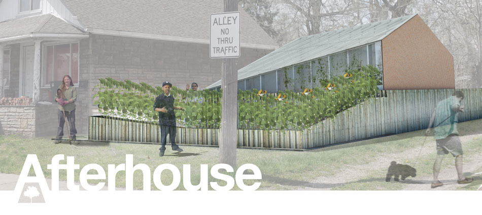
Envisioned by Steven Mankouche from Archolab, the Afterhouse, located in Detroit at 3347 Burnside, is a project highlighting sustainable blight management in Detroit. This project has created a model of innovation for Michigan and the greater "rust-belt" region. The house at 3347 Burnside instead of being completely demolished, was deconstructed to its foundation was reused as a subterranean greenhouse. This greenhouse is unique because its ability to use natural heat from the ground as well as the traditional greenhouse effect. Various plants and foods can be grown here that normally cannot be grown in Michigan such as pineapples and pistachios. This mix of architecture, green infrastructure, and community involvement has made this project wildly successful and gave the surrounding community a not only a center for healthy, organic foods, but a center for community culture on Burnside Street.
Afterhouse has been acclaimed in The Atlantic , and has one many awards for architecture and innovation. $150,000 gathered by awards, recognitions, and crowdfunding have supported the Afterhouse. It has been deemed as widely successful and has created a model in which we approach blight and revitalization in the future.
Supported by the REI University Center and:

After extensive studies looking at the most effective way to eliminate blight in a frugal manner, the researchers and stakeholders involved created a recommend set of guidelines to approach blight in Muskegon Heights. The recommendations includes commercial facade treatments, changing post-demolition norms and activities, and even using technology to map blight trends, which will help the city to be proactive in reduction of blight. The full list of recommendations can be found here. These guidelines can be applied to most blight issues occurring within your community.
$2 million of grants from HUD have been secured for Muskegon Heights and the Muskegon County Land Bank to address blight.
Supported by the REI University Center and:

This project provided an overview and the accessibility of the Makerspace movement, which is an initiative that supports creative process and innovation through providing a workshop space where amateurs and professionals interested in electronics, robotics, software, wood or metal working or art could expand their skills, invent, and build new products in a collaborative environment. The project also focused on the Makerspace programs developed by public libraries and suggests the creation of 'maker' programs at public libraries to support an innovative and entrepreneurial ecosystem.
 Supported by the REI University Center and:

The Mt. Elliot corridor is one of seven primary employment identified in the Detroit Future City Strategic Framework Plan. As of 2012, the corridor, which stretches from Eastern Market to the northern-most city limit, holds 5% of the city's employment. However, decades of decline has led to reduced city services, workforce education, blight, and crime.

Regardless, researchers concluded that the resiliency of this corridor outweighs its challenges. The district has many anchor businesses, easy access to transportation, and large parcels of vacant or underutilized industrial land. Through reinvestment and implementation of a inter-business collaboration team, researchers have concluded that the Mt. Elliot Employment District can exceed its former glory.
Through this Student-Led, Faculty-Guided Project sponsored by the REI Center at MSU, the U.S. Economic Development Administration subsequently awarded the City of Detroit $600,000 to further plan for improvements and investments within the Mt. Elliot Employment District.
Take a look at the full Forging a Future report here.
Supported by the REI University Center and:


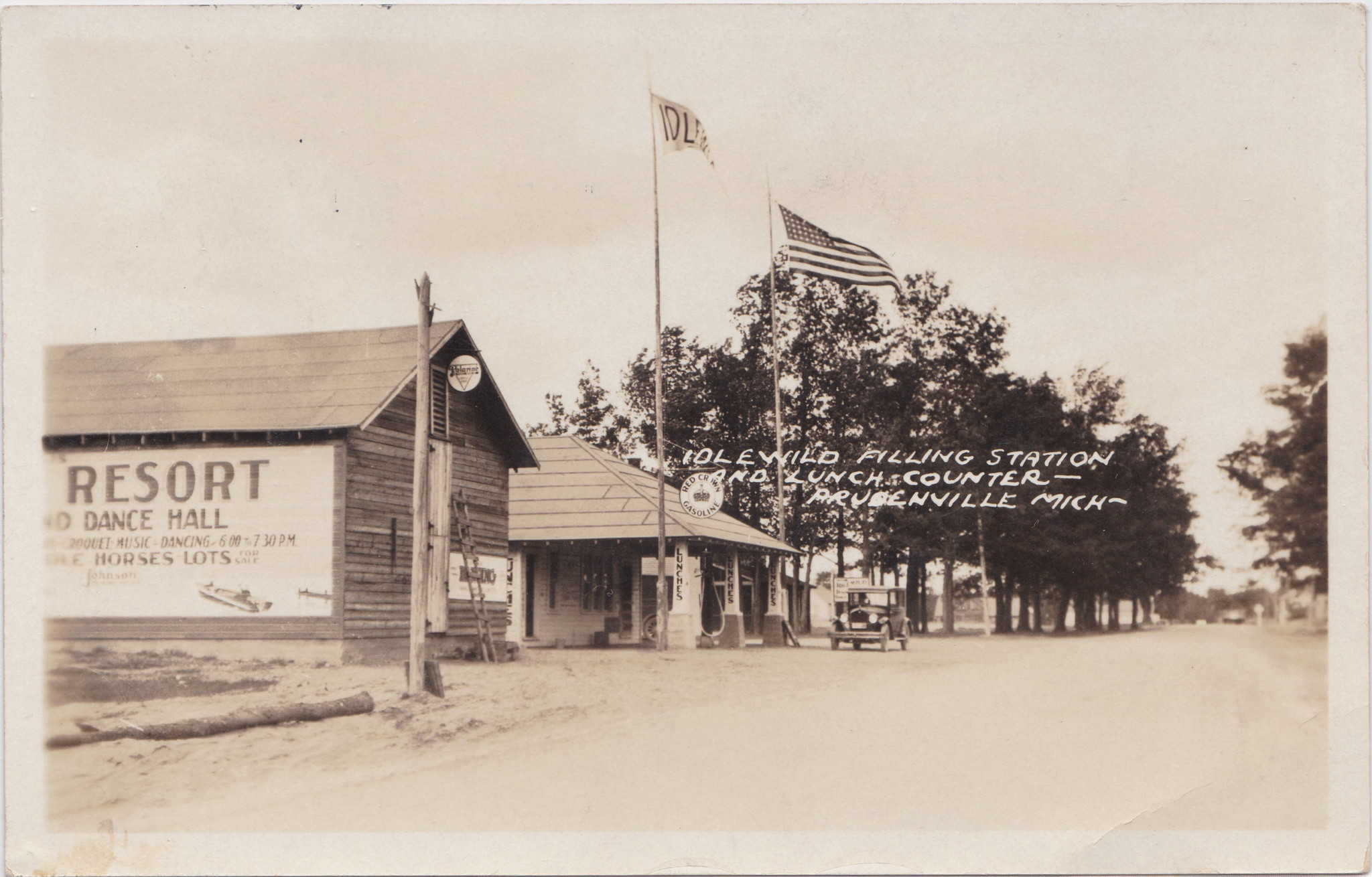
Idlewild sits just over an hour north of Grand Rapids in the Manistee National Forest. Established in 1912, it was a resort town wildly popular among the African American middle class of the Midwest with the height of its popularity being before the Civil Rights Act of 1964. Following the passage of the Civil Rights Act, which ended legalized discrimination, Idlewild�s niche dissolved and it couldn�t keep up with the expanding market.
The purpose of this project was to help with the revitalization of Idlewild as a tourist destination. To accomplish this, students partnered with the Idlewild Community Development Corporation to assess Idlewild's cultural and historical assets and potential tourist market.
A Michigan State University practicum team studied the cultural and natural assets of Idlewild, in order to devise a strategy to attract tourists. The team recommended a low-cost, grassroots style campaign to slowly improve and develop the tourist attractions before starting more any expansive project. Students found that if their strategy was fully implemented, the area could begin to develop more lodging options for tourists. Their strategy was to renovate and analyze one local site at a time to ensure success before spending marketing dollars on one-time visitors. Another recommendation was to create an office for the Idlewild Community Development Corporation (ICDC), and to open a part time position for a planning and development coordinator to attract investment to the area.
Supported by the REI University Center and:
This program has provided access to free or low-cost programs that teach people skills needed for jobs that offer sustainable wages is critical for both human and economic development in Detroit. This project provides free training in welding, career development, and communication skills. Additionally, the project offers a curriculum, describes how they connected with businesses and organizations, and gives advice on the development of similar types of free skilled-trades programs in other communities.
The REI Center at MSU has facilitated multiple studies funded internally on the effectiveness of this program. Public and Private grants are continuing this program in Detroit.

Supported by the REI University Center and:

The goal of this project was to bring together the planning and economic development tools that communities would need to designate spaces for farmers, retailers, distributors, processors, and other services, such as community kitchens, to locate near one another in ways that would serve both individual consumers and larger institutional buyers. Part of the project involved specifically defining a food innovation district. A prime example of a Food Innovation District is Eastern Market. A rising Food Innovation District that was analyzed in this report is in Northern Michigan. The practicum team worked with Networks Northwest (Formerly NWMCOG), the City of Traverse City, and surrounding municipalities to identify and analyze the historic Traverse City State Hospital as a rising site for filling the qualifications of being a Food Innovation District.
Supported by the REI University Center and:

MSU, partnered with the EDA, is proud to announce the establishment of the Food Processing Innovation Center (FPIC). The FPIC is designed to be Michigan�s leading independent commercial food development, processing, packaging and research facility. It will provide a �Real Time� production environment to support the creation of vibrant new food products, servicing the needs of both Michigan-based existing food businesses or larger scale startups in Michigan and the Great Lakes region.
The FPIC�s unique advantage is that it will be a fully licensed USDA/FDA certified food processing facility not only capable of creating new products or processes, but the ability to produce full scale medium size production runs for the retail marketplace. The FPIC�s turnkey capability allows businesses to recapture costs through product sales validating and mitigating the risk of product development and expansion programs for mid-sized processors throughout Michigan and Great Lakes region.
Currently, the FPIC is about to move into the construction the phase of implementation pending the approval of the MSU Board of Trustees.
The project involves a renovated campus building south of the Main Campus off of Jolly Rd.

Supported by the REI University Center and:
Multiple grants has resulted in $50,000 to help train Michigan's Small Businesses and Workers on technology to positively impact their business.
Supported by the REI University Center and:
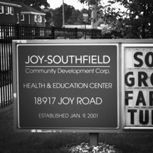
This Student-Led, Faculty-Guided project out of Wayne State University created a sub-plan for the Cody-Rouge corridor for the Joy-Southfield Community Development Corporation (JSCDC). Demographically, this neighborhood is an average Detroit neighborhood. However, with community cooperation, strong ties to the environment, and support through the REI Center at MSU and the Urban Studies and Planning program at Wayne State University, the JSCDC was able to raise over $50 million to be invested in roads, schools, parks, and the farmers market in the Cody-Rouge neighborhood. This investment has made transportation easier with bicycle lanes, access to good and healthy food, and a renovated school. The JSCDC is continually working with the academic community to further improve the neighborhood. Businesses such as Verndale Products, Inc. are opening in the neighborhood and investing in the green industry.
Supported by the REI University Center and:

REI uses electronic mailing lists and social media to communicate and interact with the Networks. Please join our LinkedIn Group and follow @MSU_REI on Twitter to stay connected, and use the sign up form to join the email list. Regulary visit reicenter.org for our latest updates and initiatives.
University Center for Regional Economic Innovation
Center for Community and Economic Development
1615 E. Michigan Ave
Lansing, MI 48912
(517) 353-9555
rei@msu.edu