

Discovering and applying new and innovative economic development tools, models, policies, and programs
Creating Jobs and Wealth in Distressed Michigan Communities

The City of Sterling Heights is seeking a corridor study document that reviews the existing conditions and provides data for the Office of Planning including the type of businesses, amount of residential units, traffic counts, and other conditions that can be evaluated by the Office for working with future developers. This will include numerical data, empirical data, maps, and other unique types of data gathering the students will have freedom to explore. There is the opportunity to meet with community members, appointed or elected officials, and City staff to accomplish their goals. Ideally, the students will have the opportunity to present at a Planning Commission meeting and to City Staff so that this can be used as a planning tool moving forward.

The Downtown Lansing Riverfront Revitalization Project focuses on planning and community engagement to enhance the river trail and riverfront area. The initiative builds on existing planning efforts and aims to achieve several key objectives.
First, trail improvements will enhance neighborhood connections, signage, lighting, and safety while working to "naturalize" the riverbank as much as possible. Second, the project will prioritize public space activation, including the development of new gathering areas, recreational amenities, and green spaces to foster a vibrant community atmosphere. Community engagement is a cornerstone of the initiative, ensuring residents and stakeholders are actively involved in the planning and design process to align outcomes with local needs and preferences. Finally, the project will address opportunities for private development by identifying and assessing Lansing-owned parcels along the riverfront to determine their best use and contribution to the area's revitalization.
The overarching goals are to identify optimal uses for the riverfront, plan dynamic public spaces, and engage the community in creating a shared vision for Downtown Lansing's riverfront transformation.

The City of Beaverton seeks to revitalize its downtown area by reimagining the use of Municipal and privately owned surface parking tots. This capstone project with focus on conducting a comprehensive parking study and proposing a forward-thinking development plan that balances parking needs with progressive urban planning practices to enhance vibrancy, sustainability, and economic potential.
Initial research focused on analyzing the use of Michigan Act 425 Agreements as tools for infrastructure expansion and economic development across jurisdictional lines. However, through comprehensive outreach and interviews with local units of government possessing water or sewer infrastructure in the 10-county region of Northwest Lower Michigan, it has become clear that a broader scope was required. While intergovernmental agreements remain the most common approach to infrastructure coordination, the majority are not Act 425 Agreements as originally assumed. Instead, communities are primarily utilizing Franchise Agreements and Master Utility Agreements, with Annexation rarely - if ever - considered. These findings point to a broader, more complex landscape of collaborative infrastructure planning. This research will explore the range of agreement types in use, analyze patterns within opportunity zones, and highlight the implications for economic development without overemphasizing a single legal mechanism.
Even though state licensed appraisers play a critical role in Michigan’s residential real estate market, there appears to be very little known about those individuals who are licensed. National fair housing organizations paint the occupation with a broad brush stating over 95% are older white males and there appears to be no initiative to recruit and develop diverse talent into the occupation. The State of Michigan has little to say about this observation. Acknowledging decades of consistent appraisal valuation challenges in the City of Detroit for residential homes, and a long history of racial discrimination in housing, this paper will use public data to detail what is publicly known about licensed appraisers in Michigan in the period from 1990 to 2022. With information available and in the open, this important regulated occupation can be better studied and analyzed to determine if appraisers reflect the communities served or determine if what national fair housing organizations claim is true for the US is also true, specifically in Michigan.
Underutilized lands, deteriorating facades, and a streetscape that does not support vibrant street life and walking continue to be the district's major challenges. It is driven by this that the district has difficulty in attracting investment and taking full advantage of the opportunities around it to reach its full potential. To build on the success of downtown Muskegon and create a unique identity as a district to brand itself as an investment hotspot and promote its existing local businesses and services, Muskegon business district needs revitalization and enhancement of its urban space vibrancy, as well as assisting city officials in establishment of an association to represent the interests of its members. The goal of the project is to transform the Pine Street Corridor into an equitable and sustainable business district with a vibrant public realm, to provide an excellent platform for existing businesses, goods, and services to flourish, as well as brand the area as a hotspot for future investments. This will be accomplished by enhancing walkability and creating a distinctive and unified streetscape that will give the district a unique identity and reinforce the sidewalk as an essential element of the public realm.
The growing adoption of electric vehicles (EVs) carries many potential benefits for sustainability and mobility, yet not all residents and communities may benefit equally. New technologies disrupt current systems and behaviors that may include uneven impacts on communities based on income, race, identity, and location. This proposal will examine the social implications of EVs for Asset Limited, Income Constrained, Employed (ALICE) residents of Michigan, both at the state level and in urban/rural areas of concentration. In particular, the focus will be access to the benefits of EVs (mobility, employment) and experience of disadvantages such as environmental damage and health.
The study area is experiencing varying levels of urban blight and deterioration brought on by years of neglect. The area is located south of Capital Region International Airport which provides many opportunities for redevelopment. Proximity to the airport and its recurring noise is a potential deterrent for potential investors. The purpose of the future research is to correct and prevent deterioration in key corridors and to create a welcoming entry point into the City of Lansing. In addition, future research will highlight and promote neighborhood aligned growth and development.
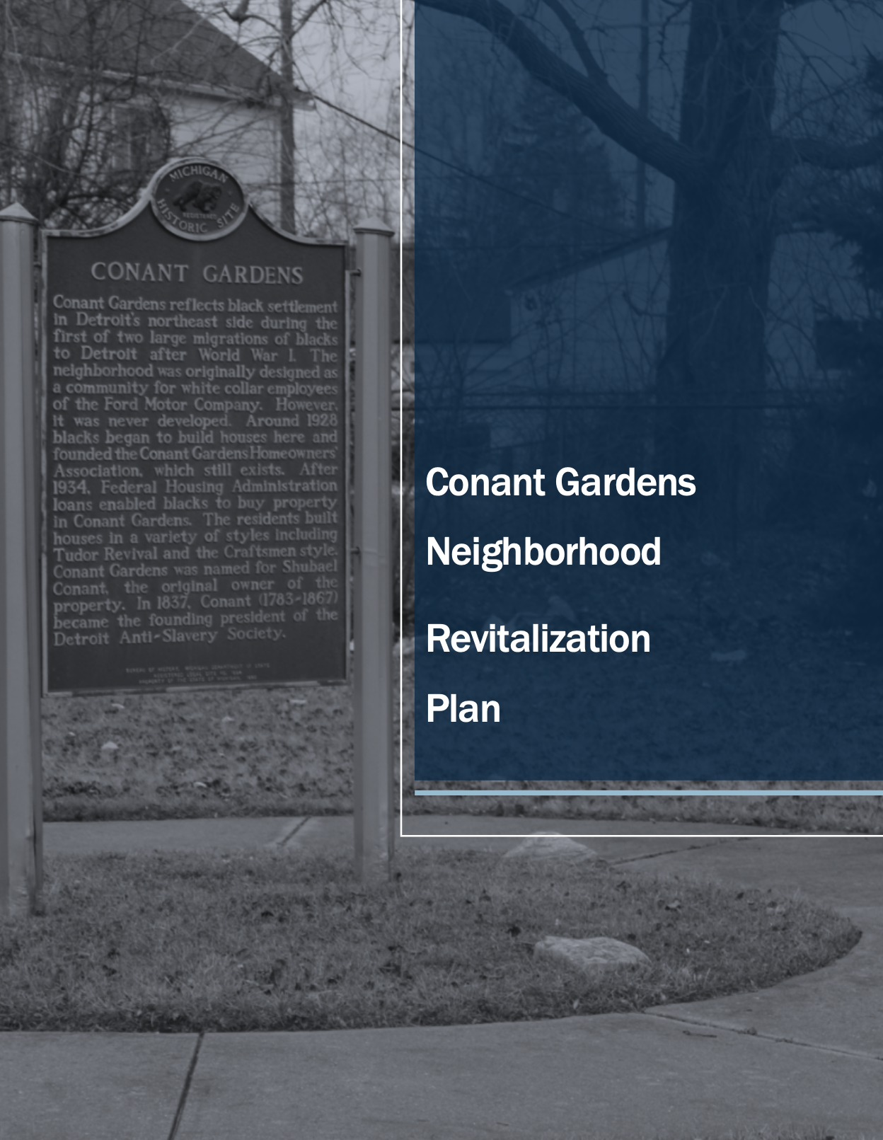
Conant Gardens as a neighborhood and community is seeing a myriad of changes take place. A once beautiful and thriving setting is now largely viewed as urban decay. Core issues concern matters of socioeconomic decline, lack of essential services, changes in dedicated property ownership including absentee landlords and overall environmental deterioration that are altering the community's dynamic status and negatively impacting financial stability, wellness and safe environment conditions. The goal of this project is to provide the Conant Garden Neighborhood Development Corporation (CGNDC) with a plan that will be the foundation for action implementation. The plan will delineate base strategies for neighborhood stabilization (around issues of housing, open public spaces, internal road system). The strategies will also - when relevant and possible - define funding possibilities, a timeline for implementation, and strategies for replicability and scalability.
The Wayne County Land Bank Corporation was formed in 2006 through an agreement between the Wayne County Treasurer and the Michigan Land Bank Fast Track Authority. The mission of the Land Bank is to return tax-foreclosed and abandoned properties to productive use, contribute tax revenue to Wayne County, and promote community rehabilitation across its municipalities. In this project, The Wayne County Land Bank (WCLB) will work with a research partner to identify opportunities to expand WCLB programs and strengthen the positive presence of the organization in key neighborhoods throughout Wayne County. The results of this research will help create strategies for the WCLB to return vacant and abandoned property to productive use. Ideally, the research will uncover which of the existing WCLB are the strongest programs based on how they address community needs, the number of properties returned to productive use, and how well it fits the WCLB’s mission. Utilizing these strategies, the WCLB will be able to influence the future direction of the disposition and rehabilitation programs to better serve our communities. The plan will also identify target areas for the WCLB to address in future years to help the communities who need the most assistance.
The WCLB also wishes to introduce a new generation of planners to the policies, benefits, and intricacies of working with Land Banks; and, to help usher in a new group of professionals to advocate for the positive benefits that land banking can achieve in our communities. Ultimately the WCLB is working to develop a strategic plan that explores the past successes of the WCLB programs and identifies opportunities to expand these programs to new geographies to increase their impact based on policy-oriented and data-based solutions. This includes analyzing the existing property condition and sales data from the past 5 years and seeing which programs have had the most success in Wayne County thus far. Using this data, the practicum team will forecast which programs are anticipated to have the greatest success in rehabbing and disposing of properties as the County works to recover from the COVID-19 pandemic. As a result of this project, the WCLB would also like the team to create neighborhood maps showing property conditions and areas where the WCLB has been.
Vanguard Community Development is a non-profit community development corporation, founded in 1994 under the ministry of Edgar A. Vann and Second Ebenezer Church. Today, Vanguard is an independent community-based stalwart champion of Detroit’s Historic North End and continues to provide programs and services to the North End in the areas of Housing Development, Community Engagement and Planning and Economic Development. As part of Vanguard’s economic development footprint, Vanguard manages a commercial campus along the E. Grand Boulevard corridor in the North End Business District. This district was recently awarded a National Main Street designation (select level) in 2020. Since 2019, the area has seen a recent boom in development activity with over 5 new restaurants and multiple residential developments slated to begin construction.
Vanguard is planning to acquire 9,584 square feet of commercial property on E. Grand Boulevard, adjacent to their Community Campus. This Student-Led, Faculty, Guided project would include a feasibility study to determine the market for potential uses/tenants for the space, as well as a development plan for the use of this commercial property should they acquire it. In addition to this building, students could also look at the other two buildings on the campus to see if they have a better use than the existing uses (Goodwill store and offices). This project will firstly help Vanguard CDC make an educated financial decision on whether to buy this commercial property, adding to the CDC’s financial resiliency. In addition to that, the project will address the community/neighborhood needs and help low-income residents avail themselves of services that they may not otherwise be able to get, as the neighborhood has also been facing some gentrification. Uses such as co-working spaces with good internet infrastructure, makerspace, small business incubators also add to resiliency planning as well as provide 21st century communications infrastructure.
There is a long-term, largely unmitigated, affordable housing crisis in the City of Detroit, with a long history of housing segregation, redlining, and their historic impact on. Focusing on the period from 2015 to 2019, data makes clear that the traditional mortgage market does not serve the needs of Detroiters. This Innovation Fellowship will build upon 2021 research to seek solutions to a systems level market failure. There are incredibly limited avenues for low-median income Detroiters to become homeowners. This project will become a natural outgrowth of the paper David Palmer authored in 2014, with support from Prior 2020 Innovation Fellow Angela Barbash’s, “Community Based Investing: Crowdfunding and the Michigan Invests Locally Exemption” project. Palmer’s project will expand upon the actors Barbash mapped in 2020, as well as add to the “Community Capital Accelerant” project that Chris Miller established in his 2021 Innovation Fellowship. The economic development challenge addressed with this project will address a specific systems failure in the City of Detroit, leveraging the tools and building upon the work of Barbash, Miller, and many others to develop solutions not currently available in the marketplace.
The economic development focus of this project is significantly different from previous REI projects focused in Detroit. This project will focus on building solutions to systems level failures. The economic development focus of this work includes three components:
1. Homebuyer education: improved outcomes through regular facilitated convening and improvement to data tracking and reporting.
2. Community Development Fund: organizations in Detroit need access to a funding source(s) that will make slow money available to finance the acquisition, renovation, and sale of properties to low-median income Detroiters.
3. Portfolio Mortgage Fund: low-median income Detroiters who have completed homebuyer education training are not well-serviced by traditional mortgage lenders.
A portfolio product should be created to serve this population that has underwriting, income, credit and loan amount standards that meet the needs of these borrowers. These points will evolve into a white paper during the term of this project. This Fellowship will provide the avenue, focus, and legitimacy needed to continue to grow these concepts into functioning deliverables. When this project is successful in convening and organizing scalable solutions, it will provide a template for similarly situated communities in Michigan including Flint, Saginaw and Benton Harbor.
The city of Pontiac was once a major industrial center in southeast Michigan; however, the decline of manufacturing had a severe negative impact upon the city and the health, employment security and living standards of the city’s population. The focus of this co-learning plan is on resiliency planning, with emphasis on the creation of a marketing plan and an outline of proposed steps to foster an inclusive economy in downtown Pontiac that involves the participation of the current residents of the community by leveraging opportunities to engage adjacent neighborhoods in downtown development projects. investigate methods of reengaging populations from the adjacent neighborhoods in meaningful ways: economically, culturally, and emotionally.
Outreach efforts will be made to residents of adjacent neighborhoods to the north of downtown in attempts to engage them with downtown and economic development organizations. Through surveys, interviews, and group discussions, efforts will be made to determine opportunities for downtown businesses to satisfy existing economic demands of these neighborhoods. This will take the form of a market study and business mix analysis. Additional efforts will be made to determine the viability for alternative forms of entrepreneurship that could connect the downtown to these northern adjacent neighborhoods, including opportunities to support locally owned, small-scale manufacturing. This project will result in a blueprint for the creation of an inclusive economy, in which new businesses can be established to meet existing demand. It will also stimulate new demand with buy-local programs and the creation of jobs to help fulfill that demand. The aim of this project is to identify the key economic development steps to foster the establishment of a virtuous economic cycle that builds assets for the community while creating an inclusive market for locally produced goods and services.
This project will address the opportunities and barriers to coordinated transfers between Land Banks and Community Land Trusts to create a pipeline of low-cost properties that could be redeveloped as permanently affordable housing or community serving placemaking amenities. National and local case studies will be explored to learn how a combined redevelopment plan could provide an enduring solution to pressing community needs in affordable housing and placemaking of urban vacant land. Ultimately, it is anticipated this project will provide land banks in Michigan with a greater awareness for opportunities to collaborate with Community Land Trusts to achieve affordable housing and placemaking objectives.
Despite the heightened visibility on the inequities many people/groups are facing (notably wealth and entrepreneurship within Black and Hispanic communities), many economic development organizations (EDOs) have yet to develop a toolbox consisting of programs, collaborations, and policies to fully address these issues in order enhance prosperity for all within their region. This Co-Learning Plan project will be the creation of detailed playbook that EDOs can equip to address many inequities their communities are facing.
This practicum project was conducted during the spring semester (January-April) of 2021 and is a collaboration between the Michigan State University Urban and Regional Planning Program and the City of Westland. The purpose of this project was to outline strategies to revitalize the Westland Mall, located in Westland, Michigan as a more productive economic contributor to the city. The strategies described in this report provide a framework and vision for the future repurposing of the mall property.
Demographic research included in this report contains a socioeconomic profile which was used to determine current characteristics of the City of Westland’s population. Socioeconomic data relevant to the future of the Westland Mall includes trends of population and housing market. The median age of the City of Westland population has been increasing over the years, rising from 37.8 to 40.2 between the years of 2010 and 2019. Housing information shows single-family housing is the largest housing type for the city but within 5 years, there has been more demand for affordable housing including multi-family residential.
The Retail Market Place Profile included in this report was conducted to determine which retail sectors are in highest demand for the area. This profile uncovers sectors with retail leakage, or product types that require the local population to travel outside their community to purchase goods. The data suggests encouraging tenants in various retail sectors may generate increases in retail transactions and foot traffic.
Land use data for the City of Westland was provided to the Practicum Team by the City of Westland. Analysis of this data combined with observations from a site visit to the property indicates the Westland Mall is located in a commercial corridor. This commercial area is surrounded mainly by single-family residential neighborhoods, commercial, and industrial retail. The existing conditions survey highlighted poor pedestrian and bicycle access to the mall site and minimal connectivity to the surrounding properties.
This report also includes the following: a site assessment detailing the Westland Mall and surrounding properties; a review of literature on current trends for shopping mall lifecycles; two case studies of revitalized malls and one case study of a similar mall in the redevelopment planning phase; stakeholder outreach analysis; and an examination of the Strengths, Weaknesses, Aspirations, and Results (SWAR) of the Westland Mall.
The recommendations for the potential repurposing of the Westland Mall are based primarily on the demographic, economic, and existing conditions data collected by the Practicum Team and case study analysis. Community dialogue and stakeholder outreach was also considered in crafting these recommendations. These recommendations are proposed in three phases with each phase serving as a guide for redevelopment. Recommendations are as follows:
Phase 1: Conceptual Plan involves creating a plan which is walkable, connected, has green infrastructure, streamlined, design, affordable housing, economic development opportunities, efficient land use, establishes block structure, and creates new recreational assets. It is also recommended to create two conceptual redevelopment plans, one plan which keeps the existing anchor stores and demolishes interior sections, and the other plan will completely demolish the entire mall structure.
Phase 2: The Design and Redevelopment Phase will incorporate master planning and policy and ordinance changes to facilitate the transformation of the mall into an urban district. This will help create an opportunity for long term and/or short-term value by selling plots of third-party developers. It is recommended to create design standards reflecting human scale, where buildings are connected to the streets and no more than five stories high; encompasses grid style block structure which promotes walkability; allow for variety in parking with limits on surface lots; and ensure the public realm is comfortable, clean, and safe.
Phase 3: The Redevelopment Strategy Phase incorporates the redevelopment strategy where the city issues requests for proposals from developers. Each development team might have their own ideas for how to implement the master plan, but they must agree to the development standards outlined in the master plan. Developers bring varied capacity and unique experiences from other projects which are encouraged to be evaluated in public meetings and/or by the development committee which created the master plan. The process then can continue with selecting the development partners which best fits the community’s vision for the redevelopment. Proceeding this step, will be finalizing the site plan and development agreements.
The recommendations presented in this report, coupled with the data collected, suggests there are several opportunities to revitalize the Westland Mall. The mall is in a supportive community, where it benefits from a large population of homeowners and families, and a great location with potential to be a point of attraction. Though the property has experienced an increasing number of vacancies, data shows the demand for certain types of retailers and amenities is still present in the City of Westland. Finally, much research already exists illustrating how other struggling shopping centers have repurposed and revitalized their properties; proving there is success in these types of projects. The data and recommendations presented in this report detail the steps the City of Westland can take to successfully revitalize their shopping center into a mixed-use urban district.
This study is the result of a partnership between the St. Clair County Metropolitan Planning Commission and the Urban and Regional Planning Program at Michigan State University (MSU). Five team members of MSU's practicum course have provided recommendations that will assist the City of St. Clair in the redevelopment of former school properties in their community. During the 2021 spring semester, practicum students went on site visits, analyzed socio-economic data, created an asset analysis, and conducted community engagement surveys amongst other tasks to determine the best recommendations for the future use of the properties.
The City of St. Clair lies within the East China School District. After declining enrollment and a failed bond effort, the district has decided to close two elementary schools located in St. Clair; Eddy Elementary School and Gearing Elementary School. The closure of the two facilities and the development potential of the vacant land have created a unique development opportunity for the City of St. Clair.
Once data collection was completed, recommendations were made for the future development of this site. Socio-economic and demographic data gave insight on the low-unemployment rate, the increasing educational attainment level and the increase in median household income in St. Clair over the last two decades. The median age of residents is 44 years of age, which is higher than the state average meaning that in the next two decades a majority of the current population of St. Clair will be 60 years of age or older. In addition, a community survey was completed by 156 people to help identify the values held by the residents of St. Clair and where they would like to see improvement. Survey respondents valued their close-knit community as well as safety. Three areas of improvements were greenspace, walkability, and commercial space. Survey respondents were also asked what they would like to see implemented and the top three choices were affordable housing (38.5%), community center (23.6%), and parks and trails (17.5%). The demographic data and community engagement of this study have assisted in the recommendations and case studies below:
Community Center: St. Clair values its close-knit community and having a multi-use development that includes a space for residents to connect is suggested for development in the site of Gearing Elementary School. The East Olive Elementary School case study includes the repurposing of a school into a Community Center. Childcare, fitness center, as well as a library amongst other amenities were implemented in this case study which could be done successfully for Gearing Elementary. Funding for the St. Clair Community Center is suggested to come from Blue Meets Green for redevelopment costs as well as support with local resources.
Senior Housing: With a population that is aging, affordable senior housing is a potential option to consider in the reuse of Eddy Elementary School. The Liberty Hyde Bailey Center case study resembles Eddy elementary in that it is a reuse of a historic elementary school. This project was developed by PK Development and Capital Area Housing Partnership, and received funding from Federal Low-Income Housing Tax Credits (LIHTC), and Federal Historic Preservation Tax Incentives. For the reuse of Eddy Elementary, the Brownfield Redevelopment Tax Increment Revenue and the County’s Housing Program Income are suggested funding options.
Community Pool: Many survey respondents desire a community pool to serve the neighborhoods around the school sites. This new pool is suggested to be located on one of the vacant lots. The city’s next steps should be to begin looking into a feasibility study and a site suitability analysis to better assess if this location would be ideal. As one of the sites has train tracks, to ensure safety of the development the Michigan 4-H Children’s Garden case study in East Lansing was used to determine best practices for the pool development. A children’s activity space was safely constructed near an active railway and could be used as a resource for the vacant lot. Potential funding could come from the Land and Water Conservation Fund, which focuses on protecting natural areas, water resources and cultural heritage, and to provide recreation opportunities.
Park and Trails: The City of St. Clair currently has beautiful parks and trails. To keep the character of the city and also apply the desires of community input, using the additional vacant lot for more trails and park space is recommended. It is suggested that the city’s Parks and Recreation Department be contacted to determine if replicating a park in St. Clair with multiple trails would be the best choice here. Michigan Natural Resources Trust Fund (MNRTF) grants may be a good source of funding for development of the park. One of the criteria of this particular grant is for projects that will provide access to natural resources and conservation which could be implemented with the trails.
The overall goal of these recommendations is to incorporate the needs and desires of the community while also being mindful of the feasibility of each project.
The CLOS Corridor Redevelopment Study Report is a product of Michigan State University’s Spring 2021 Semester Urban and Regional Planning Practicum class. The report examines the intersections of Cedar Street, Larch Street, Oakland Avenue, and Saginaw Highway, 0.5 miles northeast of downtown Lansing and provides illustration and explanation regarding the changes that can be expected to occur in Lansing due to newly enacted form-based zoning codes. The reason for the undertaking of this study is to generate a comprehensive analysis of the area’s potential for future growth under form-based zoning codes, as well as the preservation of the existing historical characteristics of the area. The report is designed to be material for presentation to stakeholders within the Lansing community, such as the Michigan Department of Transportation (MDOT), real estate developers, and individual community members.
To gain a better understanding of the demographics, economic characteristics, and current conditions of the CLOS Study Area, data was collected from several sources including the U.S. Census Bureau, ESRI Business Analyst, and local documentation. This data was combined with primary data collected by the practicum team via site visits and stakeholder discussions.
Socio-economic data was used to analyze current demographic and economic characteristics for the block group that the CLOS Study Area is situated mostly within. Analysis revealed that residents in the neighborhood earn lower incomes on average than in other neighborhoods situated around comparable major intersections in the Lansing area. Residents also rent at rates nearly 1.75 times higher than those comparable Lansing-area intersections, while other characteristics like racial makeup, age, and employment are relatively similar to the comparable areas.
Zoning and land use information, provided by the City of Lansing, combined with multiple site visits found that the area’s land use is largely composed of auto-oriented commercial properties with vacant lots and clusters of residential homes scattered throughout. Infrastructure and traffic data, largely sourced from MDOT, reveals that the CLOS intersections have been the site of dozens of pedestrian and bicyclist collisions over the past 10 years and 1,289 auto accidents―over 1,000 more than similar Lansing area intersections. This suggests that serious accommodations need to be made for non-motorized commuters going forward with development.
Recommendations within this report are primarily based on socio-economic data, property data, employment sector data, the practicum team’s assessment of current conditions along the corridor, a community outreach survey performed by the Lansing Corridor Improvement Authority, and the included case study research on noteworthy form-based zoning practices. These recommendations are primarily intended as possible suggestions and imaginations of future developments and should not be received as prescriptions for specific site development or design.
The Lansing Practicum Team isolated four sites within the CLOS Study Area that we believe to be prime for future development. These four locations are all vacant as of 2021, so new infill development at these locations under the 2021 Lansing Form-Based Zoning Codes would likely be easier and more attractive for both the Lansing community and potential developers. These sites would develop under form-based zoning codes, and the four locations will be zoned as either DT-1 Urban Edge and DT-2 Urban Flex districts, which are summarized in this report. Numerous different land uses and structure designs could be built at these vacant locations in Lansing’s future. This report has identified and illustrated a small number of possible designs, yet we believe these to be the most probable based on the data and information analyzed throughout this study.
Street design recommendations included in this report are based on the practicum team’s analyses and case study research where it is apparent that good design and amenities play a critical role in attracting businesses, residents, and clientele to the corridor. Recommendations regarding street amenities include providing increased numbers of street amenities such as benches, bike racks, and signage as some specific examples. In terms of streetscape design, the practicum team has offered visual suggestions of how strategies like road dieting and the redesign of right-of-ways can be utilized to make transit of all kinds more safe, controlled, and enjoyable throughout the CLOS Study Area.
The data and information analyzed throughout this study suggest that there are many opportunities for the CLOS Study Area to redevelop itself as a successful mixed-use Corridor and component of the overall Lansing community. The study area itself has access to a variety of beneficial assets and attractions, and is located down the road from a world-class academic institution at Michigan State University as well as the state capitol of Michigan. Through a strong local planning approach and a unified vision amongst stakeholders, the data and recommendations within this report can assist both the public and private sectors in making decisions that enable appropriate development within the CLOS Study Area.
The research required multi-level and mixed methodological analysis. The project begins with gaining historical understanding of Brightmoor and NWDND, residents’ and officers’ stories (oral histories - about 10). Then work with NWDND residents and officers to construct and distribute some in-depth, qualitative interviews and survey instruments (250 households, plus a sample of households that may have moved out of the neighborhood if they have a forwarding address). Some of these surveys will be completed electronically using Qualtrics and some number to be determined may have to be administered as a paper survey if the household doesn’t have a computer or smart phone. Then code digital archival data of Tenant Certification information (identities of residents will be struck from these documents) that are collected every year. We will set up an evaluation protocol of main factors across these data to provide an assessment of the conditions that contribute to the desirability and sustainability of tenancy of residents in their homes and their attitudes towards living in the Brightmoor neighborhood. SEMCOG and the regional EDD has pledged support for the project.
This project aimed to comprehensively examine the challenges of excessive unproductive land rather than isolated and individual approaches that may or may not align with concurrent community initiatives in the East Canfield Village located on the Eastside of Detroit. Three deliverables were produced as a result of community engagement efforts, several field analyses and thorough research of greenway initiatives both within other Detroit neighborhoods and across the country: 1) a holistic high-level vacant land use strategy for East Canfield Village; 2) a detailed design vision for the “Canfield Connect,” a neighborhood greenway, comprised of a network of vacant contiguous and/or adjacent lots, and 3) a complete Detroit Land Bank Authority acquisition application that will allow the Canfield Consortium to make this project a reality. The expectation is that these 3 products will seamlessly and successfully stitch together multiple neighborhood and community revitalization initiatives seeking to strengthen affordable housing, improve resident health, spur workforce and entrepreneurial opportunities, encourage smaller/informal neighborhood hubs, improve mobility and support more productive and innovative landscapes.
This project was a collaborative relationship Canfield Consortium Community Development Corporation and residents of the East Canfield Village in Detroit and Wayne State University.
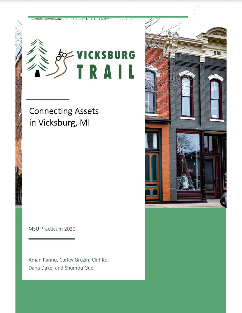
This project focused on placemaking in the Village of Vicksburg in Kalamazoo, Michigan. The village features the iconic abandoned Mill at Vicksburg which is currently eager for revitalization. Students worked to make Vicksburg a destination by connecting the mill to the downtown area through a bike trail that starts at the Trailhead Historic Village and ends at the Mill campus. The students also considered ways in which the art and culture of Vicksburg can be celebrated and enhanced. Through the innovative ideas that were produced throughout the project, Vicksburg will become a destination spot.
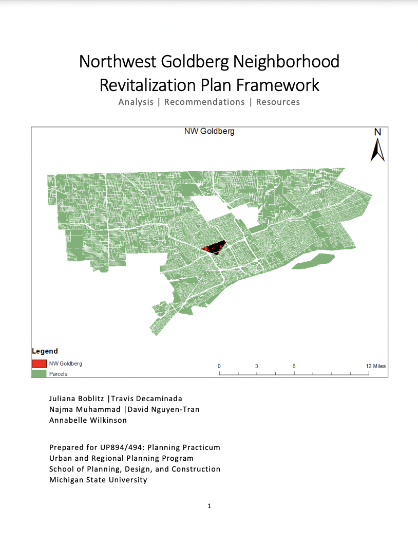
This project worked to develop a neighborhood plan for all of the Northwest Goldberg neighborhood in Detroit, Michigan. It focused on bringing new ideas and stakeholders into the western part of this neighborhood as new development occurs in the area. Beneficial ideas for neighborhood development strategies that fit the needs of the area and its people emerged from the research conducted throughout this project. The neighborhood will be able to grow from the potential that it already holds.
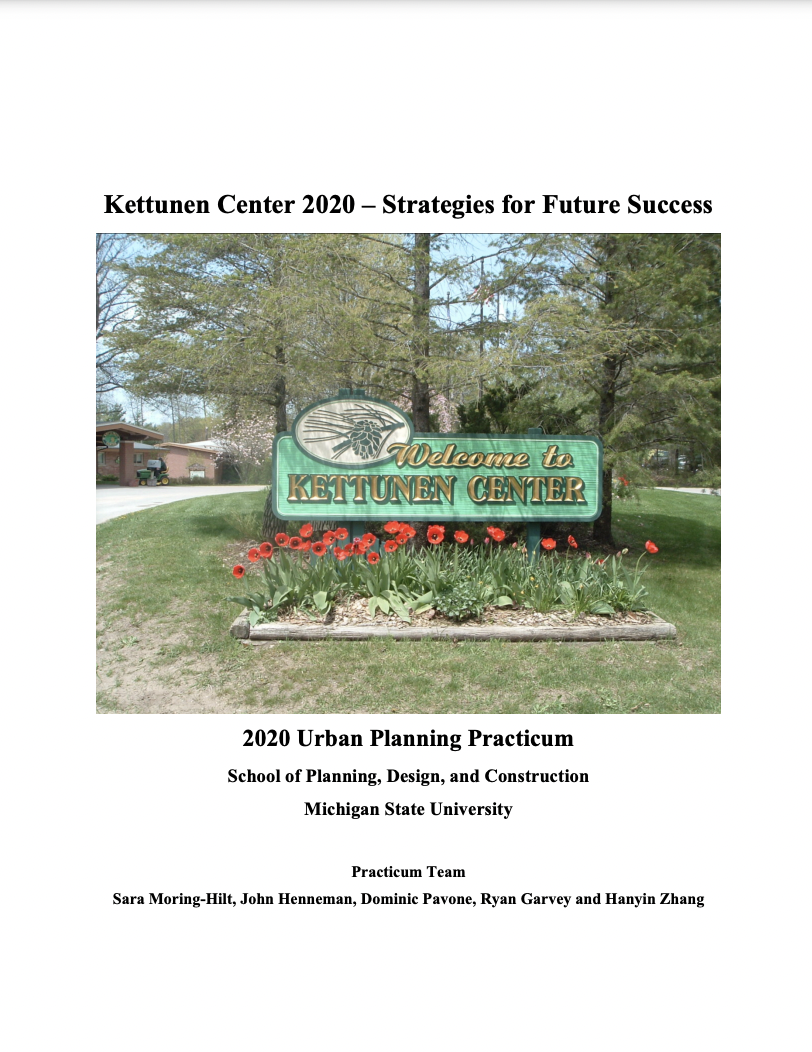
This project will allow the Kettunen Center of Tustin, Michigan to gain strategies for future success. The center is currently a conference and retreat center that is owned and operated by Michigan 4-H. Their primary goal is to bring new life to the center while engaging youth on a broader scale. In order to reach the center’s full potential, students will work to utilize their research by bringing new, innovative ideas to the forefront that will be able to bring success to the center and reach a wider group of youth.
Improved infrastructure has a myriad of economic and social benefits. Critical infrastructure is often identified with the public utility sectors. Funding and financing are sometimes confused as means of addressing infrastructure needs. How we pay for infrastructure (taxes or user fees) matters in terms of economic efficiency (costs) and distributional equity (cost allocation). In Michigan, constitutional law and legal precedents complicate the challenge. Disparities among communities are reflected in infrastructure disparities, and these issues are especially acute in distressed communities. This project will explore policies, practices, and alternative models to address infrastructure challenges.
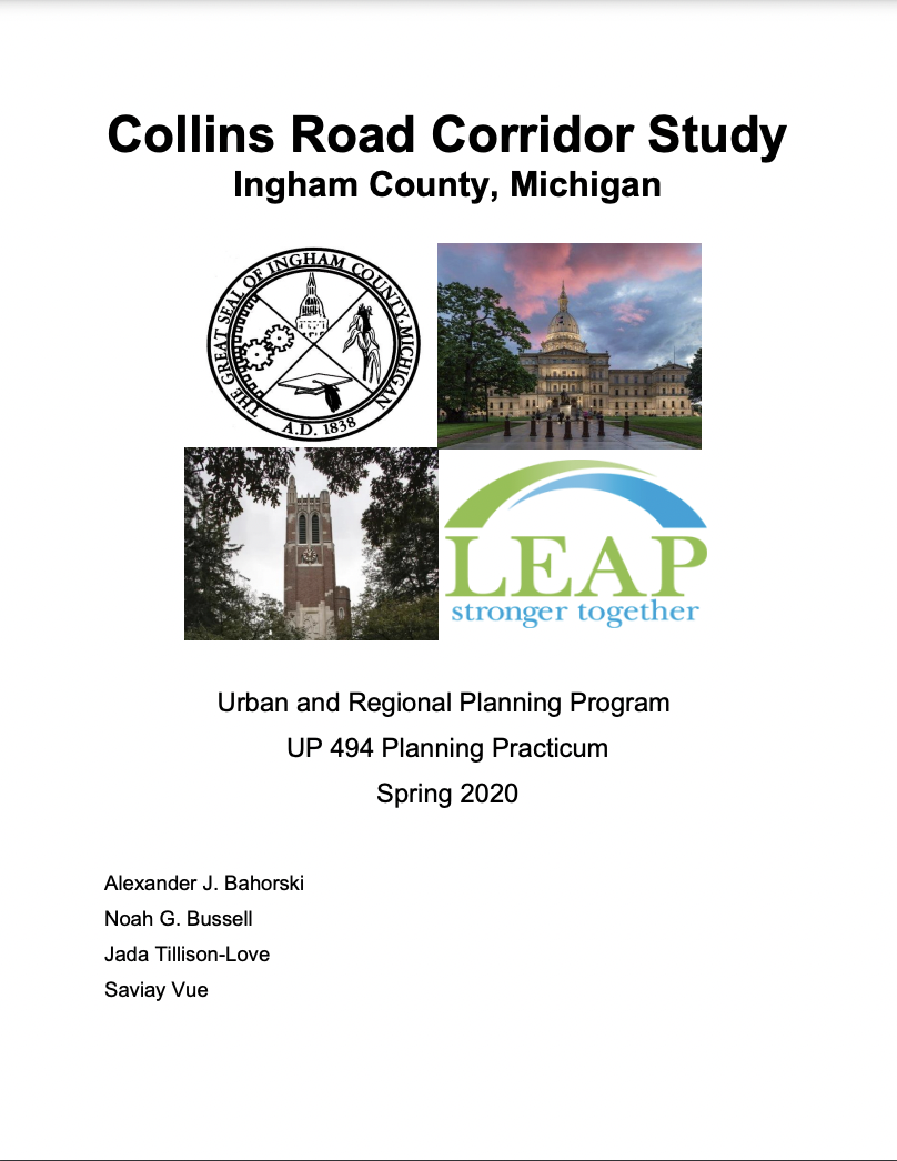
This project is centered around the 1.5-mile-long Collins Road Corridor in Lansing, Michigan. There is currently a significant amount of development occurring along the corridor that will bring immense change and this project allowed the corridor to be ready for that change. Through conversation with many stakeholders and intense research regarding the zoning, market, and infrastructure of the corridor, a shared vision will be developed for the area.
Drawing on lessons learned from working with partners in award-winning Smart City projects in Columbus, Kansas City, Portland, Denver, and Chicago, Dr. Monberg’s work is focused on helping to build a civil society infrastructure scaled to meet the needs of the callings and opportunities created by Smart City technology infrastructures.
Working with local city managers in Lansing, Detroit, Grand Rapids, Ann Arbor, and Kalamazoo, this project will lead to the creation of a usable humanities framework for leaders grappling with the consequences of new Smart City initiatives by drawing upon sophisticated humanities perspectives to create a coherent vision that builds on the collaboration of many community stakeholders, identify techniques for genuine community outreach and engagement, and formulate ethical principles around issues of equity, participation, representation, and deliberation.
Michael Moreno and Nathaniel Hooper researched the efficacy of using Tiny Homes to meet the affordable housing needs of Michigan communities, and how innovative building practices can mitigate some of the negative environmental impacts of these structures. This project compared the social, economic, and environmental impacts of building Tiny Homes using a Domicological approach versus traditional building methods. The aim of this project was to provide economic and community developers an insight into how life-cycle design practices can empower Michigan communities to transform abandoned structures into affordable Tiny Homes.
This Co-Learning plan will examine the implementation of municipal master plans and capital improvement plans in the context of the challenges with public infrastructure systems and the opportunities for a future blue and green economy. Statewide information will be assessed and ten municipal profiles will be developed and compared representing a range of counties, cities, townships, and villages based on population size, economic characteristics, and geographic location including the core communities of Benton Harbor, Detroit, Flint and Grand Rapids. Legislative, policy and strategic management reforms will be recommended to overcome impediments and to optimize public infrastructure systems in enhancing economic growth, protecting health, and increasing sustainability.
Smart cities represent the future of urban and infrastructure development. This project aims to provide a holistic picture of the past, current, and trends of smart cities while retaining a focus on the state of Michigan. This project will focus on the electric-vehicle (EV) charging infrastructure to support a smart city using a Detroit-based case study. A mixed-methods approach will be used including survey, statistical analysis, and computer-based simulation. The outcomes will provide quantifiable evidence about smart cities and infrastructure development to Michigan leaders and provide policy implications for the Michigan automobile industry.
The Co-Learning Plan provides an analysis of federal, state and local policies designed to direct publicly funded infrastructure investments for strategic economic development purposes. Public policies from multiple levels of government are assessed based on factors such as geographic context, program criteria, economic impact, effects on equity, efficiency of job creation and investment leverage. Data is drawn from public documents, surveys and interviews with local and state officials from across the country, and policy staff in national and regional development associations. A framework is recommended for Michigan to address the state’s infrastructure crisis while also investing in economic development in order to move Michigan forward with true economic growth. In addition to adequate resources for implementation, the policy framework needs to have four features: a) an integrated infrastructure systems planning partnership; b) an infrastructure bank with a diverse portfolio; c) a set of flexible tools for economic development; d) incentives to increase area wide equity and sustainability.
In collaboration with the Muskegon County Land Bank Authority, this project identified properties for blight elimination and green space, constructed zoning strategies and place making plans, and developed planning objectives for long term community stabilization.
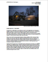
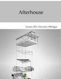
This was the third and final investment into the Afterhouse project. The Afterhouse premise was to convert a derelict house in a community in Detroit north of Hamtramck into a greenhouse. This particular phase was the completion of the construction of the greenhouse, and this parcel serves as a prototype for future projects with similar intentions.
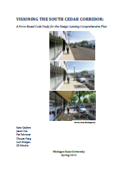
The South Cedar Corridor has proven its significant value as an integral corridor for the city of Lansing and surrounding region. Building upon the Design Lansing comprehensive plan, this report detailed recommendations and improvements which will further increase new residential and business opportunities and take advantage of existing potential.
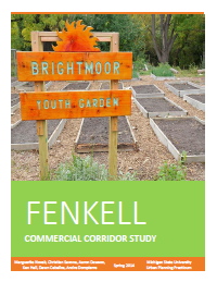
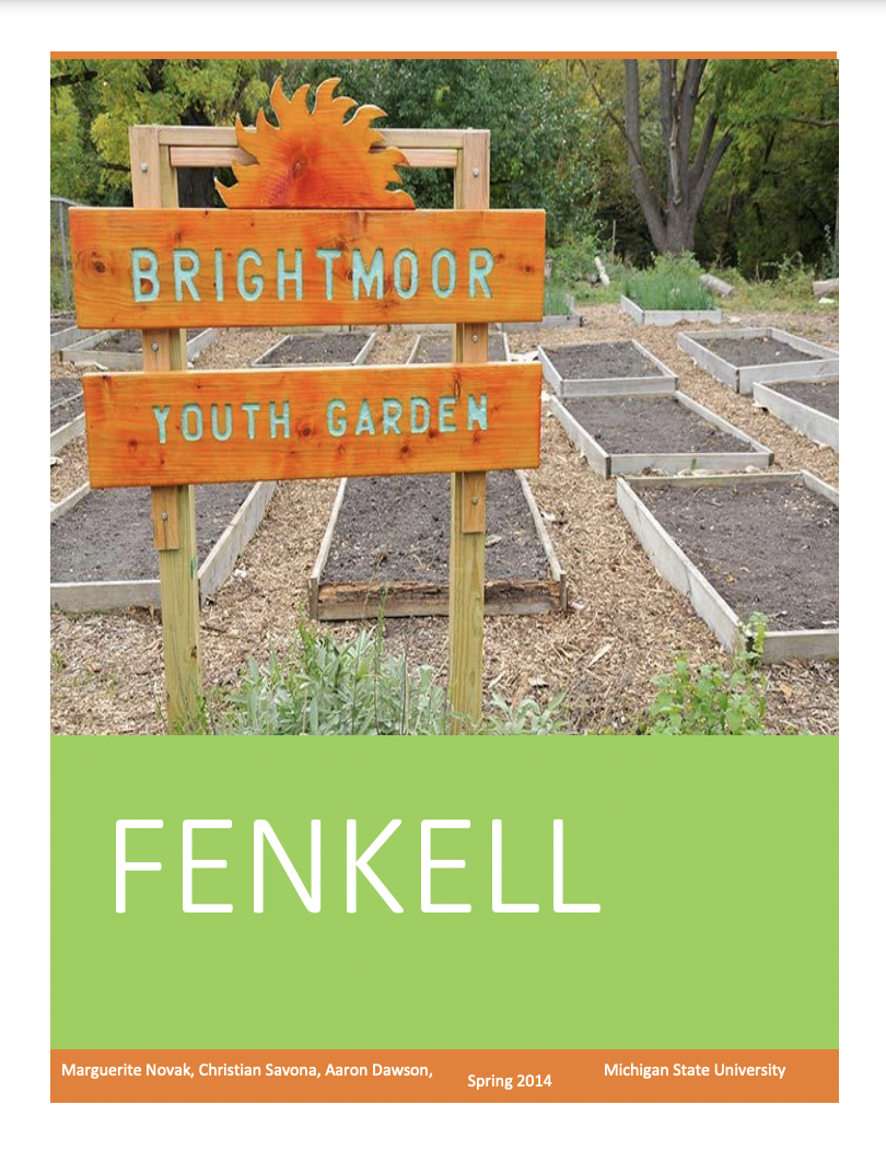
This report examined current trends and recommendations to rejuvenate the main commercial corridor in the neighborhood. Consisting of a socioeconomic analysis, a review of previous Brightmoor studies, an analysis of Strengths, Weaknesses, Opportunities, and Threats (S.W.O.T.), a comparative market study, parcel corridor evaluation of current physical conditions, and recommendations, this project is a valuable resource for communities interested in neighborhood rejuvenation.
This project evaluated the feasibility of reusing abandoned property in Detroit. Afterhouse looked at the reuse of a specific abandoned structure on 3347 Burnside. A group of students, artists, architects, and faculty from University of Michigan's Taubman College deconstructed the house in order to reuse the house's foundation for a semi subterranean geothermal greenhouse. This prototype serves as a model to be replicated in order to increase the city's economic viability.
This project facilitated discussion and meaningful conversation about the negative externalities of poverty and to identify strategies that can be used to reduce poverty in Berrien County, MI. Some of Western Michigan University’s nursing and social work students were the facilitators of such a discussion in Berrien County throughout the course of the project.
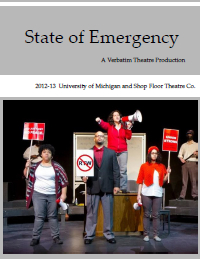
A new ensemble-based theatre company created through original, community based theatre that creatively responds to urgent issues facing the city of Flint and surrounding communities. State of Emergency was created in the verbatim theatre style, where the script is made up of recorded interviews from various residents of the city of Flint and members of the Emergency Financial Managers team.
This project evaluated the feasibility of reusing abandoned property in Detroit. Afterhouse looked at the reuse of a specific abandoned structure on 3347 Burnside. A group of students, artists, architects, and faculty from University of Michigan's Taubman College deconstructed the house in order to reuse the house's foundation for a semi subterranean geothermal greenhouse. This prototype serves as a model to be replicated in order to increase the city's economic viability.
This Co-Learning Plan examined development trends in Detroit. Since Midtown Detroit has shown signs of resilience in the face of Detroit's recent economic shortcomings, it was the focus area of this report. The report went through recent and past development in Midtown, a brief introduction to the developers, and where the main points of development are in Midtown. The paper looked at these key areas while maintaining that the strategy of real estate-led economic development is an underlying reason for Midtown's level of success.
This project applied the anchor strategy to areas in Detroit outside of Midtown. The anchor strategy is the idea that large, non-profit institutions play a major role in catalyzing business development and creating "a powerful synergy with the local business community." The project looked at four specific anchors: University of Detroit-Mercy, Marygrove College, Holy Redeemer Catholic Church, and St. John Hospital and Medical Center. The report itself contains an overview of the anchor strategy model, a look at other markets, a demographic overview of identified communities, the anchor strategy as it pertains to each of the aforementioned anchors, and recommendations to applying the anchor strategy model in Detroit.